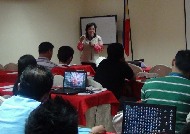
 DILG Region III conducted two batches of Basic Training on Quantum Geographic Information System (QGIS) for LGUs on September 10-12, 2014 and September 16-18, 2014 at Subic Bay Traveler’s Hotel, Olongapo City. The training was aimed to capacitate the LGUs in disaster preparedness and response, and climate change adoption by using Quantum GIS, a free and open source software which can be used to create maps. Participants consisted mainly of the Disaster Risk Reduction Management Officers (DRRMOs) and IT staff of 26 LGUs which are located in the Pampanga River Basin (PRB) and/or considered to be prone to hazards. With a good grasp of QGIS, the DRRMOs and staffs could surely help the LGUs in the formulation of detailed plans with the help of the accurate determination of hazard-prone areas, formation of evacuation routes, and drawing of barangay hazard maps among others.
Regional Director Florida M. Dijan, in her message, encouraged the participants to take full advantage of the available technologies in the implementation of programs and projects. In addition, RD Dijan hoped that the outcome of the training will enable them to recommend new strategies and innovations in the LGU aside from the mere creation of maps.
Resource speakers from the Housing and Land Use Regulatory Board (HLURB). Housing and Homesite Regulations Officer III (HHRO III) Danny D. Palomo, together with HHRO II Engr. Julia Angela Mae E. Collado RPAE were tapped. They discussed the basic use of the open-source software, the processes of digitizing and geo-referencing, and the usage of GPS devices for map creation.
At the end of the 3-day training, the participants were able to produce the initial target outputs which were geo-referenced city/municipality maps fitted with existing hazard maps. Further, DILG tasked the participants to make more detailed versions of their maps when they go back to their respective offices to further utilize their learning during the activity. It was also stated that the output maps could be utilized as inputs in the formulation of the Local Climate Change Action Plan (LCCAP), Comprehensive Development Plan (CDP), Comprehensive Land Use Plan (CLUP) and other development plans in the LGU.


 DILG Region III conducted two batches of Basic Training on Quantum Geographic Information System (QGIS) for LGUs on September 10-12, 2014 and September 16-18, 2014 at Subic Bay Traveler’s Hotel, Olongapo City. The training was aimed to capacitate the LGUs in disaster preparedness and response, and climate change adoption by using Quantum GIS, a free and open source software which can be used to create maps. Participants consisted mainly of the Disaster Risk Reduction Management Officers (DRRMOs) and IT staff of 26 LGUs which are located in the Pampanga River Basin (PRB) and/or considered to be prone to hazards. With a good grasp of QGIS, the DRRMOs and staffs could surely help the LGUs in the formulation of detailed plans with the help of the accurate determination of hazard-prone areas, formation of evacuation routes, and drawing of barangay hazard maps among others.


